
Category:East Dunbartonshire
Council areas (municipalities) of Scotland: Aberdeen · Aberdeenshire · Angus · Argyll and Bute · Clackmannanshire · Dumfries and Galloway · Dundee · East Ayrshire · East Dunbartonshire · East Lothian · East Renfrewshire · Edinburgh · Falkirk · Fife · Glasgow · Highland · Inverclyde · Midlothian · Moray · North Ayrshire · North Lanarkshire · Outer Hebrides · Orkney Islands · Perth and Kinross · Renfrewshire · Scottish Borders · Shetland Islands · South Ayrshire · South Lanarkshire · Stirling · West Dunbartonshire · West Lothian
council area in Scotland    | |||||
| Upload media | |||||
| Instance of | |||||
|---|---|---|---|---|---|
| Part of |
| ||||
| Location | Scotland | ||||
| Capital | |||||
| Legislative body |
| ||||
| Population |
| ||||
| Area |
| ||||
| official website | |||||
 | |||||
English: East Dunbartonshire is one of the 32 council areas of Scotland.

Subcategories
This category has the following 28 subcategories, out of 28 total.
A
B
E
G
H
I
N
P
S
T
Media in category "East Dunbartonshire"
The following 108 files are in this category, out of 108 total.
-
 A Luggie meander - geograph.org.uk - 1797216.jpg 800 × 600; 98 KB
-
 A passing train - geograph.org.uk - 7171914.jpg 1,600 × 1,200; 578 KB
-
 A Train Passing Drumbreck - geograph.org.uk - 1796606.jpg 1,159 × 775; 157 KB
-
 Access road, Heronryhill reservoir - geograph.org.uk - 8007375.jpg 4,032 × 3,024; 3.41 MB
-
 Across the flood plain - geograph.org.uk - 1797324.jpg 1,024 × 768; 576 KB
-
 Along the fence - geograph.org.uk - 1797587.jpg 800 × 600; 151 KB
-
 B802, Howe Road - geograph.org.uk - 7426113.jpg 3,245 × 2,207; 3.51 MB
-
 Badenheath Farm - geograph.org.uk - 1797610.jpg 1,024 × 768; 528 KB
-
 Badenheath Farm - geograph.org.uk - 1797629.jpg 1,024 × 768; 604 KB
-
 Bar Hill - geograph.org.uk - 1488565.jpg 640 × 480; 56 KB
-
 Bridge over the Bothlin Burn - geograph.org.uk - 6607900.jpg 1,600 × 1,200; 626 KB
-
 Bridge plaque - geograph.org.uk - 6608062.jpg 1,600 × 1,066; 496 KB
-
 Bridgeway Road - geograph.org.uk - 6608048.jpg 1,600 × 1,104; 434 KB
-
 Calfmuir Road - geograph.org.uk - 6608108.jpg 1,600 × 1,167; 498 KB
-
 Calfmuir Road - geograph.org.uk - 6608171.jpg 1,600 × 1,147; 311 KB
-
 Calfmuir Road bridge - geograph.org.uk - 7171919.jpg 1,600 × 1,200; 350 KB
-
 Canal feeder - geograph.org.uk - 7171866.jpg 1,600 × 1,201; 675 KB
-
 Come back in 2110 - geograph.org.uk - 7171825.jpg 1,248 × 1,600; 624 KB
-
 Cumbernauld from the air - geograph.org.uk - 7703172.jpg 1,600 × 900; 493 KB
-
.jpg/120px-Deerdykes_Roundabout_(geograph_2298028).jpg) Deerdykes Roundabout (geograph 2298028).jpg 640 × 480; 200 KB
Deerdykes Roundabout (geograph 2298028).jpg 640 × 480; 200 KB
-
 Digger hard at work - geograph.org.uk - 8175496.jpg 3,024 × 4,032; 3.68 MB
-
_-_geograph.org.uk_-_1796621.jpg/120px-Drumbreck_(ruin)_-_geograph.org.uk_-_1796621.jpg) Drumbreck (ruin) - geograph.org.uk - 1796621.jpg 1,159 × 775; 185 KB
Drumbreck (ruin) - geograph.org.uk - 1796621.jpg 1,159 × 775; 185 KB
-
_-_geograph.org.uk_-_1796742.jpg/120px-Drumbreck_(ruin)_-_geograph.org.uk_-_1796742.jpg) Drumbreck (ruin) - geograph.org.uk - 1796742.jpg 1,159 × 775; 256 KB
Drumbreck (ruin) - geograph.org.uk - 1796742.jpg 1,159 × 775; 256 KB
-
 Drumbreck Cottage - geograph.org.uk - 6609227.jpg 1,600 × 1,160; 321 KB
-
 Drumbreck Farm - geograph.org.uk - 1796630.jpg 1,159 × 775; 241 KB
-
 Coat of arms of East Dunbartonshire.svg 1,066 × 1,062; 702 KB
-
 Entrance to the Quakers' Cemetery - geograph.org.uk - 6609046.jpg 1,600 × 1,200; 494 KB
-
 Fallen bough, Heronry Hill - geograph.org.uk - 8007364.jpg 4,032 × 3,024; 4.86 MB
-
_-_geograph.org.uk_-_1786404.jpg/120px-Fallen_Headstone_(Friends%27_Burial_Ground)_-_geograph.org.uk_-_1786404.jpg)
-
 Fallen headstone - geograph.org.uk - 6609110.jpg 1,600 × 1,200; 670 KB
-
 Farm bridge - geograph.org.uk - 1797550.jpg 1,024 × 768; 715 KB
-
 Farm track - geograph.org.uk - 6609208.jpg 1,600 × 1,200; 559 KB
-
 Field bridge - geograph.org.uk - 1797003.jpg 800 × 600; 158 KB
-
 Field north of Sauchenhall - geograph.org.uk - 6609236.jpg 1,600 × 1,200; 428 KB
-
 Field of migrating Pink-footed geese - geograph.org.uk - 1797292.jpg 800 × 600; 170 KB
-
 Field off Langmuir Road - geograph.org.uk - 7107032.jpg 1,600 × 1,078; 363 KB
-
 Field off Langmuir Road - geograph.org.uk - 7107035.jpg 1,600 × 1,046; 337 KB
-
 Field, Wester Gartshore - geograph.org.uk - 6609166.jpg 1,600 × 1,200; 346 KB
-
 Fields near Croy Station - geograph.org.uk - 6554663.jpg 1,600 × 833; 183 KB
-
 Flats on Menzies Drive - geograph.org.uk - 7171931.jpg 1,600 × 1,130; 362 KB
-
 Flats, netball courts and play area - geograph.org.uk - 7171941.jpg 1,600 × 1,200; 538 KB
-
 Flood Plain - geograph.org.uk - 1797231.jpg 800 × 600; 116 KB
-
 Footbridge over the Bothlin Burn - geograph.org.uk - 6608031.jpg 1,600 × 1,006; 580 KB
-
 Footpath beside the railway - geograph.org.uk - 7171892.jpg 1,200 × 1,600; 685 KB
-
 Footpath beside the railway - geograph.org.uk - 7171902.jpg 1,200 × 1,600; 659 KB
-
_-_geograph.org.uk_-_1786423.jpg/120px-Friends%27_Burial_Ground_(Wester_Gartshore)_-_geograph.org.uk_-_1786423.jpg)
-
_-_geograph.org.uk_-_1786427.jpg/120px-Friends%27_Burial_Ground_(Wester_Gartshore)_-_geograph.org.uk_-_1786427.jpg)
-
 Gartshore Moss - geograph.org.uk - 1796993.jpg 800 × 600; 116 KB
-
 Gartshore Road - geograph.org.uk - 6609249.jpg 1,600 × 1,200; 320 KB
-
 Gas connection - geograph.org.uk - 6608149.jpg 1,200 × 1,600; 674 KB
-
 Gas valve - geograph.org.uk - 7172508.jpg 1,211 × 1,600; 489 KB
-
 Gravestone, Quakers' Cemetery - geograph.org.uk - 6609080.jpg 1,600 × 1,200; 627 KB
-
_-_geograph.org.uk_-_1786416.jpg/120px-Headstone_(Friends%27_Burial_Ground)_-_geograph.org.uk_-_1786416.jpg) Headstone (Friends' Burial Ground) - geograph.org.uk - 1786416.jpg 968 × 648; 278 KB
Headstone (Friends' Burial Ground) - geograph.org.uk - 1786416.jpg 968 × 648; 278 KB
-
 Horse and rider - geograph.org.uk - 6609230.jpg 1,267 × 1,600; 423 KB
-
 Houses on Calfmuir Road - geograph.org.uk - 7171916.jpg 1,600 × 1,182; 288 KB
-
 Houses on Rutherford Drive - geograph.org.uk - 7171879.jpg 1,600 × 1,200; 371 KB
-
 Houses on the outskirts of Kirkintilloch - geograph.org.uk - 7107039.jpg 1,600 × 919; 312 KB
-
 Houses, Spider Bridge Court - geograph.org.uk - 7172500.jpg 1,600 × 1,200; 425 KB
-
 Improved field drainage - geograph.org.uk - 1797009.jpg 800 × 600; 126 KB
-
 In the Luggie Valley - geograph.org.uk - 1797031.jpg 800 × 600; 84 KB
-
 Kirkintilloch, Luggie Water at Oxgang - geograph.org.uk - 1675808.jpg 1,024 × 768; 788 KB
-
 Kirkintilloch, Oxgang Bridge - geograph.org.uk - 1675800.jpg 1,024 × 768; 807 KB
-
 Langmuir Road - geograph.org.uk - 7106987.jpg 1,600 × 1,200; 422 KB
-
 Langmuir Road - geograph.org.uk - 7107027.jpg 1,600 × 1,108; 323 KB
-
 Lapwing Avenue - geograph.org.uk - 7171939.jpg 1,600 × 1,200; 414 KB
-
 Lodge gates - geograph.org.uk - 6609188.jpg 1,600 × 1,200; 524 KB
-
 Lovely sunny day near Twechar - geograph.org.uk - 8175495.jpg 2,948 × 2,748; 3.73 MB
-
 Luggie Water - geograph.org.uk - 1796587.jpg 1,159 × 775; 198 KB
-
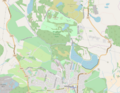 Map of Mugdock Country Park.png 914 × 711; 408 KB
-
 Menzies Drive - geograph.org.uk - 7171834.jpg 1,600 × 1,183; 473 KB
-
 Mixed plantation - geograph.org.uk - 1796987.jpg 800 × 600; 91 KB
-
_-_geograph.org.uk_-_1796578.jpg/120px-Mossfinnan_(remains)_-_geograph.org.uk_-_1796578.jpg) Mossfinnan (remains) - geograph.org.uk - 1796578.jpg 1,159 × 775; 241 KB
Mossfinnan (remains) - geograph.org.uk - 1796578.jpg 1,159 × 775; 241 KB
-
 Muddy footpath - geograph.org.uk - 7171870.jpg 1,600 × 1,200; 558 KB
-
 New access road - geograph.org.uk - 1797628.jpg 1,024 × 768; 620 KB
-
 Newlands Farm - geograph.org.uk - 1797312.jpg 800 × 600; 102 KB
-
 Older buildings, Wester Gartshore Farm - geograph.org.uk - 8007359.jpg 4,032 × 3,024; 4.32 MB
-
 On the levy - geograph.org.uk - 1797531.jpg 800 × 600; 147 KB
-
 Overhead gantry - geograph.org.uk - 6609264.jpg 1,600 × 1,100; 460 KB
-
_-_geograph.org.uk_-_1796814.jpg/120px-Playhill_(ruin)_-_geograph.org.uk_-_1796814.jpg) Playhill (ruin) - geograph.org.uk - 1796814.jpg 931 × 592; 254 KB
Playhill (ruin) - geograph.org.uk - 1796814.jpg 931 × 592; 254 KB
-
 Quakers' Cemetery - geograph.org.uk - 6609144.jpg 1,600 × 1,200; 666 KB
-
.jpg/120px-Queenzieburn_and_Kilsyth_from_the_air_(geograph_5308174).jpg) Queenzieburn and Kilsyth from the air (geograph 5308174).jpg 640 × 480; 127 KB
Queenzieburn and Kilsyth from the air (geograph 5308174).jpg 640 × 480; 127 KB
-
 Railway Line - geograph.org.uk - 7171923.jpg 1,600 × 1,240; 384 KB
-
 Railway Viaduct - geograph.org.uk - 1676797.jpg 800 × 600; 132 KB
-
 Reservoir access road, Heronry Hill - geograph.org.uk - 8007372.jpg 4,032 × 3,024; 5.14 MB
-
 Reservoir enclosure, Heronry Hill - geograph.org.uk - 8007368.jpg 4,032 × 3,024; 6.47 MB
-
 Residents of Drumgrew - geograph.org.uk - 49339.jpg 411 × 640; 112 KB
-
 Road southeast of Wester Gartshore - geograph.org.uk - 6609154.jpg 1,600 × 1,220; 610 KB
-
 Road to Heronry Hill - geograph.org.uk - 8007361.jpg 4,032 × 3,024; 4.96 MB
-
 Roundabout and litter drifts, Drumgrew Bridge - geograph.org.uk - 8007635.jpg 4,032 × 3,024; 2.77 MB
-
 Roundabout on Calfmuir Road - geograph.org.uk - 7171929.jpg 1,600 × 1,072; 273 KB
-
 Ruined building - geograph.org.uk - 6609239.jpg 1,600 × 1,115; 450 KB
-
 Sunny Heatherbank.jpg 4,080 × 3,072; 5.01 MB
-
 Temporary causeway across the Luggie - geograph.org.uk - 1797599.jpg 1,010 × 672; 675 KB
-
 The Bothlin Burn - geograph.org.uk - 7171749.jpg 1,200 × 1,600; 605 KB
-
 The home of Irn Bru - geograph.org.uk - 1797620.jpg 1,024 × 768; 572 KB
-
 The Luggie and Barbeth Farm - geograph.org.uk - 1797520.jpg 1,024 × 768; 669 KB
-
 Treeline of Gartshore Moss - geograph.org.uk - 1797022.jpg 800 × 600; 81 KB
-
 Twechar Roundabout - geograph.org.uk - 6609254.jpg 1,600 × 1,151; 305 KB
-
 Two trees on a hill - geograph.org.uk - 1796999.jpg 800 × 600; 116 KB
-
 Unused road off Drumgrew Roundabout - geograph.org.uk - 8007634.jpg 4,032 × 3,024; 3.67 MB
-
 View from Menzies Drive - geograph.org.uk - 7171934.jpg 1,600 × 1,138; 438 KB
-
 View North from Train - geograph.org.uk - 8175463.jpg 2,510 × 3,495; 7.13 MB
-
 View North towards the Campsie Fells - geograph.org.uk - 8175494.jpg 2,947 × 2,446; 3.35 MB
-
 Waterside Bing - geograph.org.uk - 6609216.jpg 1,600 × 1,068; 218 KB
-
 Wester Gartshore - geograph.org.uk - 6609008.jpg 1,600 × 1,064; 331 KB
-
 Wester Gartshore Cottages - geograph.org.uk - 6609177.jpg 1,600 × 1,224; 493 KB
-
 Woodland at Blackwood - geograph.org.uk - 6554710.jpg 1,600 × 1,159; 262 KB
-
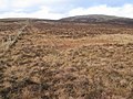 Between Owsen Hill and Little Earl - geograph.org.uk - 338492.jpg 640 × 480; 146 KB


.jpg)

_-_geograph.org.uk_-_1796621.jpg)
_-_geograph.org.uk_-_1796742.jpg)


_-_geograph.org.uk_-_1786404.jpg)


_-_geograph.org.uk_-_1786423.jpg)
_-_geograph.org.uk_-_1786427.jpg)


_-_geograph.org.uk_-_1786416.jpg)


_-_geograph.org.uk_-_1796578.jpg)


_-_geograph.org.uk_-_1796814.jpg)

.jpg)


