
Category:East Ayrshire
Council areas (municipalities) of Scotland: Aberdeen · Aberdeenshire · Angus · Argyll and Bute · Clackmannanshire · Dumfries and Galloway · Dundee · East Ayrshire · East Dunbartonshire · East Lothian · East Renfrewshire · Edinburgh · Falkirk · Fife · Glasgow · Highland · Inverclyde · Midlothian · Moray · North Ayrshire · North Lanarkshire · Outer Hebrides · Orkney Islands · Perth and Kinross · Renfrewshire · Scottish Borders · Shetland Islands · South Ayrshire · South Lanarkshire · Stirling · West Dunbartonshire · West Lothian
council area of Scotland   | |||||
| Upload media | |||||
| Instance of | |||||
|---|---|---|---|---|---|
| Part of |
| ||||
| Location | Scotland | ||||
| Capital | |||||
| Population |
| ||||
| Area |
| ||||
| official website | |||||
 | |||||


Subcategories
This category has the following 41 subcategories, out of 41 total.
A
B
- Barskimming Bridge House (6 F)
- Benches in East Ayrshire (2 F)
- Black Law Motte (7 F)
- Bloomridge Farm (5 F)
- Bridge House cave (5 F)
C
D
E
- Entrances in East Ayrshire (13 F)
F
- Fardalehill Junction (4 F)
G
H
I
M
- Maxholm (9 F)
- Mazes in East Ayrshire (2 F)
N
P
S
- Simon's Burn (6 F)
T
Media in category "East Ayrshire"
The following 200 files are in this category, out of 420 total.
(previous page) (next page)-
 'The Muckle Brig' - Galston Bridge - geograph.org.uk - 6163627.jpg 4,014 × 3,000; 2.34 MB
-
 A hump in the road over a dismantled railway line - geograph.org.uk - 7163138.jpg 1,600 × 1,067; 255 KB
-
 A muddy track through the woods at Loudoun Hill - geograph.org.uk - 7140859.jpg 1,200 × 1,600; 1,015 KB
-
 A row of beech trees - geograph.org.uk - 8062863.jpg 1,600 × 1,005; 643 KB
-
 A shed by the Pomefield Burn - geograph.org.uk - 6614618.jpg 1,600 × 1,200; 501 KB
-
 A wander up Loudoun Hill - geograph.org.uk - 7596288.jpg 1,314 × 1,600; 663 KB
-
 A713 towards Ayr - geograph.org.uk - 7635059.jpg 4,032 × 3,024; 2.69 MB
-
 A713 towards Dalmellington - geograph.org.uk - 7635062.jpg 640 × 480; 71 KB
-
 A713 towards Hollybush - geograph.org.uk - 7635063.jpg 4,032 × 3,024; 2.95 MB
-
 Abandoned workings by River Irvine - geograph.org.uk - 8088911.jpg 1,600 × 1,067; 329 KB
-
 Access to Burnfoot - geograph.org.uk - 8062857.jpg 1,600 × 1,028; 457 KB
-
 Alton Burn - geograph.org.uk - 7164547.jpg 1,600 × 1,067; 267 KB
-
 Alton farm - geograph.org.uk - 7993142.jpg 1,600 × 900; 460 KB
-
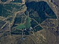
 Alton Muirhouse from the air - geograph.org.uk - 7735853.jpg 900 × 1,600; 484 KB
-
 Another victim of Storm Éowyn - geograph.org.uk - 7977086.jpg 1,600 × 739; 441 KB
-
 Anti dumping netting on old railway bridge - geograph.org.uk - 6626826.jpg 1,024 × 768; 336 KB
-
 Approaching Barr Mill, Galston - geograph.org.uk - 7993151.jpg 1,600 × 900; 468 KB
-
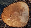 Asymmetric xylem growth in Fagus sylvatica.jpg 3,278 × 2,901; 3.64 MB
-
 At Alton Burn - geograph.org.uk - 6575168.jpg 800 × 528; 187 KB
-
 Auchinleck Castle Well steps, East Ayrshire, Scotland.jpg 4,896 × 2,752; 6.73 MB
-
 Autumn tree colours by Burn Anne - geograph.org.uk - 6634210.jpg 5,149 × 3,677; 4.05 MB
-
 Avon Bridge - geograph.org.uk - 6625714.jpg 1,024 × 768; 233 KB
-
 Avon Bridge - geograph.org.uk - 7847536.jpg 1,600 × 873; 421 KB
-
 Avon Water at Main Castle - geograph.org.uk - 6130257.jpg 2,309 × 1,732; 997 KB
-
 Avon Water north of Main Castle - geograph.org.uk - 6130307.jpg 5,149 × 3,678; 4.36 MB
-
 Bankend Rig Wind Farm road - geograph.org.uk - 6625779.jpg 1,024 × 768; 202 KB
-
 Bankend Rig Wind Farm sign.jpg 1,024 × 768; 283 KB
-
 Barr Mill - Galston - geograph.org.uk - 6169622.jpg 4,118 × 3,088; 3.6 MB
-
 Beech trees at Knowehead - geograph.org.uk - 7163127.jpg 1,600 × 1,032; 224 KB
-
 Beech-lined track below Loudoun Hill - geograph.org.uk - 7155230.jpg 3,780 × 5,040; 7.42 MB
-
 Beware flooding^ - geograph.org.uk - 6523651.jpg 1,024 × 576; 264 KB
-
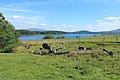
 Boats on Loch Doon - geograph.org.uk - 5800723.jpg 2,976 × 1,984; 3.8 MB
-
 Bridge on a minor country road - geograph.org.uk - 7269088.jpg 4,160 × 3,120; 1.65 MB
-
 Broomhill cattle - geograph.org.uk - 6519652.jpg 800 × 530; 151 KB
-
 Brown’s Institute - Galston - geograph.org.uk - 6163722.jpg 4,145 × 3,109; 4.24 MB
-
 Buildings at Nether Newton - geograph.org.uk - 7993140.jpg 1,600 × 900; 428 KB
-
 Buildings at Winkinfield - geograph.org.uk - 8155898.jpg 2,682 × 2,012; 2.05 MB
-

-
 Burnanne House - Galston - geograph.org.uk - 6128214.jpg 4,010 × 3,007; 2.92 MB
-
 Burnhead - geograph.org.uk - 6625767.jpg 1,024 × 768; 293 KB
-
 Buttercup meadow at Windshields - geograph.org.uk - 8061257.jpg 1,600 × 1,066; 473 KB
-
 Cairn and rushes on Watstone Hill - geograph.org.uk - 6414150.jpg 5,085 × 3,633; 4.83 MB
-
 Cairn on Distinkhorn - geograph.org.uk - 6614683.jpg 1,600 × 1,200; 733 KB
-
 Cairn on Watstone Hill - geograph.org.uk - 6614728.jpg 1,600 × 1,200; 601 KB
-
 Cairn on Watstone Hill - geograph.org.uk - 7457692.jpg 5,184 × 3,888; 7.06 MB
-
 Cairnsaigh - geograph.org.uk - 6625726.jpg 1,024 × 768; 371 KB
-
 Cairnsaigh - geograph.org.uk - 6625728.jpg 1,024 × 768; 315 KB
-
 Cairnsaigh - geograph.org.uk - 6626817.jpg 1,024 × 768; 293 KB
-
 Cairnsaigh Hill - geograph.org.uk - 6625698.jpg 1,024 × 768; 259 KB
-
 Cairntable Village memorial - geograph.org.uk - 6519643.jpg 800 × 600; 283 KB
-
 Carinsaigh - geograph.org.uk - 6625724.jpg 1,024 × 768; 330 KB
-
 Cattle at Nether Newton - geograph.org.uk - 6575164.jpg 800 × 561; 159 KB
-
 Cattle at rest - geograph.org.uk - 8155891.jpg 3,648 × 2,736; 4.11 MB
-
 Cattle at West Ashyard - geograph.org.uk - 6570161.jpg 800 × 600; 166 KB
-
 Cattle at West Newton - geograph.org.uk - 6575161.jpg 800 × 505; 129 KB
-
 Cattle grazing with Loudoun Hill in the background - geograph.org.uk - 7897866.jpg 3,072 × 1,843; 999 KB
-
 Cessnock Water from Shaws Bridge, Dallars, East Ayrshire. View downstream.jpg 4,896 × 2,752; 4.1 MB
-
 Chair Stone, Distinkhorn - geograph.org.uk - 6614702.jpg 1,600 × 1,200; 787 KB
-
 Changue Hill from the air - geograph.org.uk - 6063731.jpg 1,024 × 768; 328 KB
-
 Changue Hill from the air - geograph.org.uk - 6063734.jpg 1,024 × 768; 341 KB
-
 Chris Hoy Cycle Way - geograph.org.uk - 6149723.jpg 3,418 × 2,565; 1.24 MB
-
 Climbers on Loudoun Hill - geograph.org.uk - 7597471.jpg 1,600 × 1,067; 481 KB
-
 Coat of Arms of East Ayrshire.svg 1,554 × 1,067; 780 KB
-
 Collapsed dry stone dyke - geograph.org.uk - 8155951.jpg 3,398 × 2,549; 3.42 MB
-
 Conifer plantation Middlefield - geograph.org.uk - 6901456.jpg 1,024 × 768; 489 KB
-
 Crawlaw Farm view - geograph.org.uk - 6566555.jpg 800 × 462; 108 KB
-
 Crest of the Royal Arms of Scotland.jpg 1,260 × 945; 194 KB
-
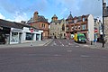 Cumnock town centre, Scotland.jpg 1,920 × 1,280; 1.35 MB
-
 Dairy cattle in the Irvine Valley - geograph.org.uk - 6575105.jpg 800 × 452; 102 KB
-
 Darvel and Strathaven Railway Line - geograph.org.uk - 6166623.jpg 3,899 × 2,923; 2.16 MB
-
 Darvel transmitter from the air - geograph.org.uk - 6063745.jpg 1,024 × 768; 402 KB
-
 Downhill to East Newton - geograph.org.uk - 7165950.jpg 1,600 × 1,067; 465 KB
-
 Downstream view, Pogiven Burn - geograph.org.uk - 7035533.jpg 5,184 × 3,888; 6.39 MB
-
 Drone technology in the Whitelee Wind Farm - geograph.org.uk - 6779371.jpg 1,024 × 575; 36 KB
-
 Drone technology in the Whitelee Wind Farm - geograph.org.uk - 6779374.jpg 1,024 × 574; 127 KB
-
 Dumfries House, Marquess of Bute Memorial, 1900, East Ayrshire.jpg 4,608 × 3,456; 3.61 MB
-
 Dunaskin Church, East Ayrshire, Scotland.jpg 1,920 × 939; 695 KB
-
 Dunston Hill restoration - geograph.org.uk - 6515810.jpg 800 × 560; 176 KB
-
 Dunstonhill Colliery restoration site - geograph.org.uk - 6515853.jpg 800 × 567; 177 KB
-
 Dykehead Farm - Darvel - geograph.org.uk - 6163895.jpg 4,320 × 3,240; 4.76 MB
-
 East Ayrshire Council 2017.svg 360 × 185; 2 KB
-
.jpg/120px-East_Ayrshire_Council_Headquarters%2C_Kilmarnock_(cropped).jpg) East Ayrshire Council Headquarters, Kilmarnock (cropped).jpg 1,983 × 1,302; 811 KB
East Ayrshire Council Headquarters, Kilmarnock (cropped).jpg 1,983 × 1,302; 811 KB
-
 East Ayrshire Council Headquarters, Kilmarnock.jpg 2,304 × 1,728; 1.3 MB
-
 East Ayrshire grazing land - geograph.org.uk - 6519640.jpg 800 × 601; 217 KB
-
 East Burnhead Farm - geograph.org.uk - 6166637.jpg 3,892 × 2,918; 5 MB
-

-
 East Threepwood Farm Steading - geograph.org.uk - 6146515.jpg 3,718 × 2,788; 2.12 MB
-
 East Threepwood Farm Streading - geograph.org.uk - 6145081.jpg 4,320 × 3,240; 6.6 MB
-
 EastAyrshireCouncil 2017.svg 360 × 185; 2 KB
-
 Eastern flank of Loudoun Hill - geograph.org.uk - 7841163.jpg 5,184 × 3,888; 5.68 MB
-
 Eddie Fraser, CEO East Ayrshire Council.jpg 179 × 268; 7 KB
-
 Edge of Loch Doon - geograph.org.uk - 4872416.jpg 4,896 × 3,672; 6.4 MB
-
 Electricity pylon at East Hungryhill - geograph.org.uk - 7164538.jpg 1,600 × 1,066; 263 KB
-
 Enterkine House Lodge, Weston Bridge, Annbank, East Ayrshire.jpg 4,608 × 2,882; 5.33 MB
-
 Exidiopsis effusa induced 'Hair Ice or Ice Wool' on dead wood, Lainshaw, East Ayrshire.jpg 4,602 × 3,152; 3.86 MB
-
 Exidiopsis effusa induced 'Hair Ice' on dead wood, Lainshaw Woods, East Ayrshire.jpg 4,608 × 3,456; 4.14 MB
-
 Exidiopsis effusa induced 'Hair Ice' on dead wood, Lainshaw, East Ayrshire, Scotland.jpg 4,608 × 3,456; 3.61 MB
-
 Exidiopsis effusa induced 'Hair Ice' on dead wood, Lainshaw, East Ayrshire.jpg 4,608 × 3,456; 4.11 MB
-
 Farmland by the Tongue Burn - geograph.org.uk - 6407052.jpg 2,309 × 1,732; 1,021 KB
-
 Farquhar Coat of arms - Gilmilnscroft House , Sorn, East Ayrshire.jpg 3,643 × 2,740; 2.43 MB
-
 Fenceline below Mule Hill - geograph.org.uk - 7457696.jpg 5,184 × 3,888; 6.47 MB
-
 Fenceline crossing Avon Head - geograph.org.uk - 7457709.jpg 5,184 × 3,888; 6.43 MB
-
 Feoch Farm - Darvel - geograph.org.uk - 6146140.jpg 4,112 × 3,085; 2.54 MB
-
 Field boundary near Threepwood - geograph.org.uk - 6634187.jpg 5,148 × 3,677; 5.35 MB
-
 Fields on both sides of River Irvine - geograph.org.uk - 8155955.jpg 4,080 × 3,072; 5.81 MB
-
 Flood control system - geograph.org.uk - 6566551.jpg 800 × 535; 152 KB
-

-
 Flowerbank Early Childhood Centre, Kilmarnock, Scotland.jpg 3,264 × 2,448; 1.11 MB
-
 Following Mucks Water glen - geograph.org.uk - 8061264.jpg 1,600 × 1,067; 501 KB
-
 Footbridge over the Tulloch Burn - geograph.org.uk - 6139101.jpg 2,309 × 1,732; 1.06 MB
-
 Ford and footbridge at Ladystone Linn - geograph.org.uk - 6508735.jpg 1,024 × 574; 250 KB
-
 Former quarry road and scrap Tuley tubes - geograph.org.uk - 6626865.jpg 1,024 × 768; 335 KB
-
 Former quarry road near Loudon Hill - geograph.org.uk - 6626878.jpg 1,024 × 773; 242 KB
-
 Gallow Law - Galston - geograph.org.uk - 6129989.jpg 4,320 × 3,240; 3.68 MB
-
 Gallow Law Monument - geograph.org.uk - 8136160.jpg 5,184 × 3,888; 6.83 MB
-
 Galston's Muckle Brig - geograph.org.uk - 6566473.jpg 800 × 529; 167 KB
-
 Gateposts and track, Burnhead - geograph.org.uk - 6130218.jpg 5,152 × 3,864; 6.13 MB
-
 Gateside Farm - Darvel - geograph.org.uk - 6143490.jpg 3,865 × 2,900; 2.04 MB
-
 Gilmilnscroft House , Sorn, East Ayrshire. Coat of arms.jpg 4,179 × 2,751; 2.67 MB
-
 Gilmilnscroft House , Sorn, East Ayrshire. Garden feature marriage stone.jpg 4,896 × 2,752; 3.3 MB
-
 Gilmilnscroft House , Sorn, East Ayrshire. Garden feature monogram stone.jpg 3,971 × 2,689; 2.81 MB
-
 Gilmilnscroft House , Sorn, East Ayrshire. Garden features.jpg 3,941 × 2,749; 3.6 MB
-
 Gilmilnscroft House , Sorn, East Ayrshire.jpg 4,638 × 2,401; 1.82 MB
-
 Gilmilnscroft House gardens , Sorn, East Ayrshire.jpg 4,367 × 2,179; 2.01 MB
-
 Gilmilnscroft House, Sorn, East Ayrshire. Hare coursing carving.jpg 4,695 × 1,842; 1.8 MB
-
 Gilmilnscroft House, Sorn, East Ayrshire. North-east view.jpg 3,772 × 2,682; 1.78 MB
-
 Going to Hurlford on the A71 - geograph.org.uk - 6570171.jpg 800 × 526; 179 KB
-
 Going up Dunston Hill - geograph.org.uk - 6515661.jpg 800 × 582; 198 KB
-
 Grassy track at Target Wood - geograph.org.uk - 6407034.jpg 5,152 × 3,864; 7.75 MB
-
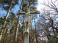
 Grave of Covenanter Thomas Fleming - geograph.org.uk - 6869823.jpg 3,240 × 4,320; 5.06 MB
-
 Grazing moorland at King's Moss - geograph.org.uk - 6614592.jpg 1,600 × 1,200; 560 KB
-
 Grazing towards the Woodhead Burn - geograph.org.uk - 6851865.jpg 800 × 499; 91 KB
-
 Hair Ice induced by Exidiopsis effusa on dead wood, Lainshaw, East Ayrshire.jpg 4,409 × 3,048; 3.75 MB
-
 Hard Hill triangulation pillar - geograph.org.uk - 6901840.jpg 1,024 × 768; 413 KB
-
 Hazel, Corylus avellana. Epicormic growth. River Ayr. Holehouse Holm, East Ayrshire.jpg 4,896 × 2,752; 5.85 MB
-
%2C_Lainshaw_Woods%2C_East_Ayrshire.jpg/120px-Hemp_Agrimony_(Eupatorium_cannabinum)%2C_Lainshaw_Woods%2C_East_Ayrshire.jpg) Hemp Agrimony (Eupatorium cannabinum), Lainshaw Woods, East Ayrshire.jpg 3,335 × 2,752; 1.67 MB
Hemp Agrimony (Eupatorium cannabinum), Lainshaw Woods, East Ayrshire.jpg 3,335 × 2,752; 1.67 MB
-
 High Carlingcraig Farm - Darvel - geograph.org.uk - 6146130.jpg 3,899 × 2,924; 3.35 MB
-
 Hillhouse farm - geograph.org.uk - 6902149.jpg 1,024 × 575; 614 KB
-
 Hillhouse from the air - geograph.org.uk - 6381416.jpg 1,024 × 768; 275 KB
-
 Horses 'taking the air' at West Loudoun - geograph.org.uk - 7993148.jpg 1,600 × 900; 405 KB
-
 House 'Altonlea' at Alton Bridge - geograph.org.uk - 7993143.jpg 1,600 × 896; 533 KB
-
 Hurlford Cross, Scotland.jpg 5,184 × 3,456; 7.29 MB
-
 Improved track to the Bankend Rig windfarm - geograph.org.uk - 6508751.jpg 1,024 × 576; 166 KB
-
 In the Whitelee Wind Farm - geograph.org.uk - 6779363.jpg 1,024 × 552; 111 KB
-
 In the Whitelee Wind Farm - geograph.org.uk - 6779364.jpg 1,024 × 575; 155 KB
-
 In the Whitelee Wind Farm - geograph.org.uk - 6779455.jpg 1,024 × 569; 247 KB
-
 Initials on mausoleum, Stewarton Churchyard, East Ayrshire, Scotland.jpg 2,759 × 1,629; 1,017 KB
-
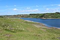
 Island in Loch Doon - geograph.org.uk - 4075915.jpg 640 × 480; 68 KB
-
 Junction of tracks near Main Castle - geograph.org.uk - 7457737.jpg 5,184 × 3,888; 4.91 MB
-
 Kerse Primary School - geograph.org.uk - 7891747.jpg 5,184 × 3,888; 7.07 MB
-
 Kerse School - geograph.org.uk - 6519648.jpg 800 × 576; 187 KB
-
 King's Moss - geograph.org.uk - 6625772.jpg 1,024 × 768; 205 KB
-
 Lady's Well, Dumfries Estate, East Ayrshire, Scotland.jpg 3,993 × 2,309; 2.55 MB
-
 Laigh Bradley Farm - Darvel - geograph.org.uk - 6143220.jpg 4,320 × 3,240; 3.39 MB
-
 Laigh Castleton Farm, Strathannick, from the Lambroughton Plantation, East Ayrshire.jpg 4,229 × 2,026; 1.11 MB
-
 Lichen-covered boulders on Loudoun Hill - geograph.org.uk - 7155232.jpg 5,098 × 3,823; 7.11 MB
-
 Linda McAulay-Griffiths.jpg 300 × 340; 20 KB
-
 Loanfoot Farm - Darvel - geograph.org.uk - 6165243.jpg 3,854 × 2,890; 2.99 MB
-
 Loanfoot Farm - Darvel - geograph.org.uk - 6166056.jpg 4,022 × 3,017; 3.96 MB
-
 Loanfoot, near Darvel - geograph.org.uk - 6139143.jpg 5,066 × 3,205; 3.3 MB
-
 Loanhead Primary School, Kilmarnock, Scotland.jpg 2,304 × 1,728; 1.22 MB
-
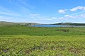
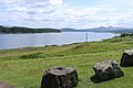
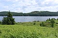
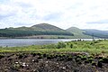
 Loch Doon - geograph.org.uk - 2838151.jpg 3,872 × 2,592; 2.98 MB
-
 Loch Doon - geograph.org.uk - 2922678.jpg 3,264 × 2,448; 2.92 MB
-
 Loch Doon - geograph.org.uk - 4008242.jpg 1,920 × 1,280; 2.04 MB
-
 Loch Doon - geograph.org.uk - 4008270.jpg 1,920 × 1,280; 1.79 MB
-
 Loch Doon - geograph.org.uk - 4008276.jpg 1,920 × 1,280; 1.67 MB
-
 Loch Doon - geograph.org.uk - 4008286.jpg 1,920 × 1,280; 1.49 MB
-
 Loch Doon - geograph.org.uk - 4008291.jpg 1,920 × 1,280; 1.87 MB
-
 Loch Doon - geograph.org.uk - 4008318.jpg 1,920 × 1,280; 1.68 MB
-
 Loch Doon - geograph.org.uk - 4008329.jpg 1,920 × 1,280; 1.82 MB
-
 Loch Doon - geograph.org.uk - 4008351.jpg 1,920 × 1,280; 1.79 MB
-
 Loch Doon - geograph.org.uk - 4008357.jpg 1,920 × 1,280; 1.85 MB
-
 Loch Doon - geograph.org.uk - 4008361.jpg 1,920 × 1,280; 1.78 MB
-
 Loch Doon - geograph.org.uk - 4008373.jpg 1,920 × 1,280; 1.57 MB
-
 Loch Doon - geograph.org.uk - 4008382.jpg 1,920 × 1,280; 1.58 MB
-
 Loch Doon - geograph.org.uk - 4008396.jpg 1,920 × 1,280; 1.41 MB
-
 Loch Doon - geograph.org.uk - 4008408.jpg 1,920 × 1,280; 1.35 MB
-
 Loch Doon - geograph.org.uk - 4008451.jpg 1,920 × 1,280; 1.7 MB
-
 Loch Doon - geograph.org.uk - 4008515.jpg 1,920 × 1,280; 1.71 MB
-
 Loch Doon - geograph.org.uk - 4008541.jpg 1,920 × 1,280; 1.44 MB
-
 Loch Doon - geograph.org.uk - 4008545.jpg 1,920 × 1,280; 1.44 MB
-
 Loch Doon - geograph.org.uk - 4008547.jpg 1,920 × 1,280; 1.39 MB
-
 Loch Doon - geograph.org.uk - 4075893.jpg 640 × 480; 56 KB
-
 Loch Doon - geograph.org.uk - 5666921.jpg 4,784 × 1,710; 7.08 MB
-
 Loch Doon - geograph.org.uk - 5800685.jpg 2,976 × 1,984; 3.21 MB
-
 Loch Doon - geograph.org.uk - 5800687.jpg 2,976 × 1,984; 3.1 MB
-
 Loch Doon - geograph.org.uk - 5800689.jpg 2,976 × 1,984; 2.82 MB
-
 Loch Doon - geograph.org.uk - 5800697.jpg 2,976 × 1,984; 3.03 MB
-
 Loch Doon - geograph.org.uk - 5800707.jpg 2,976 × 1,984; 3.47 MB
-
 Loch Doon - geograph.org.uk - 5800709.jpg 2,976 × 1,984; 2.95 MB
-
 Loch Doon - geograph.org.uk - 5800713.jpg 2,976 × 1,984; 3.42 MB
-
 Loch Doon - geograph.org.uk - 5800720.jpg 2,976 × 1,984; 3.33 MB
-
 Loch Doon - geograph.org.uk - 5800725.jpg 2,976 × 1,984; 3.03 MB
-
 Loch Doon - geograph.org.uk - 5800745.jpg 2,976 × 1,984; 3.39 MB
-
 Loch Doon - geograph.org.uk - 5800746.jpg 2,976 × 1,984; 3.04 MB
-
 Loch Doon - geograph.org.uk - 5800750.jpg 2,976 × 1,984; 3.74 MB
-
 Loch Doon - geograph.org.uk - 5800751.jpg 2,976 × 1,984; 3.62 MB
-
 Loch Doon - geograph.org.uk - 6930639.jpg 2,000 × 1,166; 2.38 MB
-
 Loch Doon - geograph.org.uk - 7802031.jpg 2,624 × 1,968; 3.07 MB
-
 Loch Doon Dam - geograph.org.uk - 2838152.jpg 3,872 × 2,592; 2.42 MB


.jpg)


,_Lainshaw_Woods,_East_Ayrshire.jpg)


